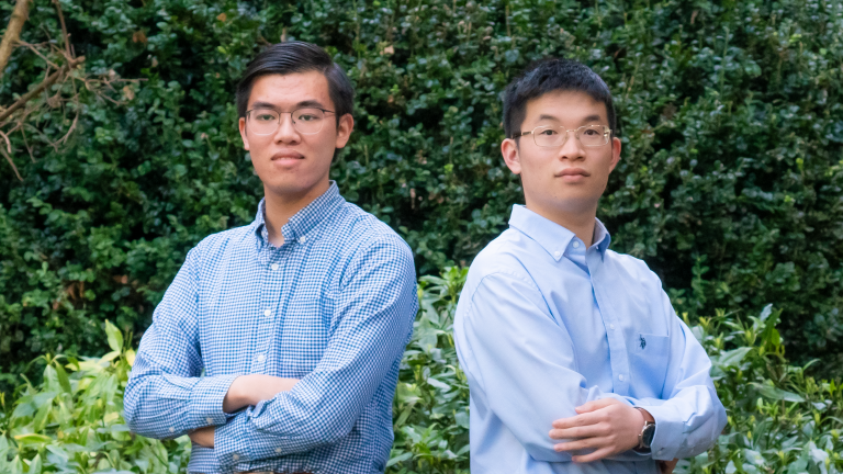
Alvin To (left) and Jack Cheng (right) founded the UBC chapter of Youthmappers. Photo by Aaron Woods.
Many remote communities around the world have a big problem – they are quite literally not on the map.
Most publicly available digital street maps are built and maintained by private companies like Google and Apple, who don’t have a financial incentive to expend mapping resources on small villages in places like West Africa. This means that vital information is unavailable to first responders who need to reach these areas in times of crisis.
UBC Geography students Jack Cheng and Alvin To want to tackle this problem, and have joined forces with an initiative called Youthmappers to set up a UBC chapter.
“[Youthmappers] is a global community of students, researchers and educators who use public geospatial technologies to respond to development needs,” Cheng explains. “The mapping that we do benefits humanitarian organizations like the Red Cross and Médecins Sans Frontières, and our work assists with development issues such as health care and planning for disasters.”
Cheng, a microbiology major with an interest in medical geography and public health, and To, a human geography major, decided to found the chapter after meeting at a Geography Students’ Association (GSA) event in early 2020.
“When everything is moved online, I was thinking of a way to find something meaningful to do during the pandemic,” says Cheng. Initially, he hosted monthly mapathons on Zoom and Discord with other students who were interested in using open mapping technology. Then, in 2021, he heard about Youthmappers and began working with To to establish a UBC chapter.
They held their first event in October 2021, co-hosted with the UBC GSA, and have since held several more — first in-person and then on Discord. Mapping themes have included access to electricity in Sierra Leone, the spread of infectious waterborne diseases in Senegal, and preparing for flood response in the Amazon basin.
Utilising a technology called OpenStreetMap (“the Wikipedia of maps,” says Cheng), participants work on a pre-made task assigned by Youthmappers, using satellite imagery to label roads, buildings, and other features. Then, local mappers on the ground in that country can fill in the details — for example, which building is a hospital, school or power station.
“Sierra Leone is one country that we map a lot,” says Cheng. “They have Youthmappers chapters there too. Their members can go and verify, and get ground based imagery of these locations.”
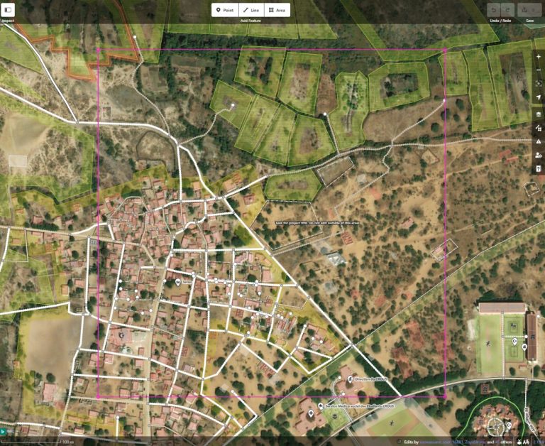
One of the group’s early projects was to work on mapping villages in Saint Louis, Senegal, to address the epidemic of schistosomiasis – a widespread water-borne diseases. Here, the mappers are adding houses to ensure that villages are accurately tabulated. Image courtesy of Youthmappers UBC.
“The main benefit of using OpenStreetMap, as opposed to more established platforms like Google or Apple Maps,” says To, “is the open source nature of the information.” Mappers can use the service free of charge, as can local communities or humanitarian organizations who need access to the resulting data. Students can also use information on the platform in GIS projects.
With its Wikipedia-like model, OpenStreetMap can be edited by anyone, but does have a team of validators who go back over the information to make sure it’s accurate, says Cheng. Its use is expanding too, he says. “Many hiking trail apps are starting to use OpenStreetMap, because it really incorporates the knowledge of the locals.”
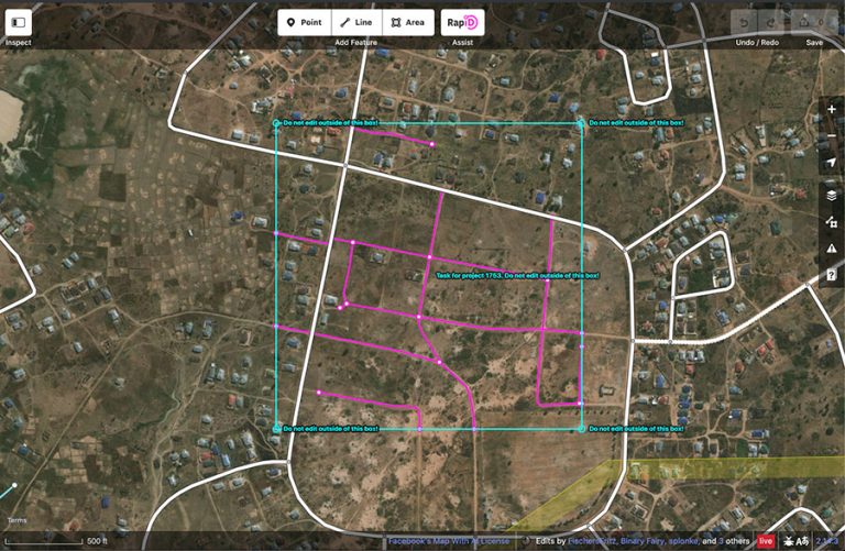
Artificial intelligence – in this case RapID – is used to aid with filling in coverage gaps. Here, the previously unmapped roads are highlighted in pink. Image courtesy of Youthmappers UBC.
As for getting involved with the UBC chapter of YouthMappers – no previous mapping experience is required! It is designed to be easy and accessible to anyone who is interested, says Cheng.
“The motto of Youthmappers is, ‘we don’t just build maps, we build mappers,’ and so one of our goals is to build that community and connect students with each other. We also invite speakers who are experts in the field – for example, the UBC Library’s GIS Librarian Evan Thornberry, so we can grow as a group.”
Overall, Cheng and To hope that the group will continue to expand, and to keep contributing to efforts like the Missing Maps Project. “These places are often the most prone to disasters. The goal is to put people on the map.”
You can find out more about how to get involved with Youthmappers at UBC on the GSA website.